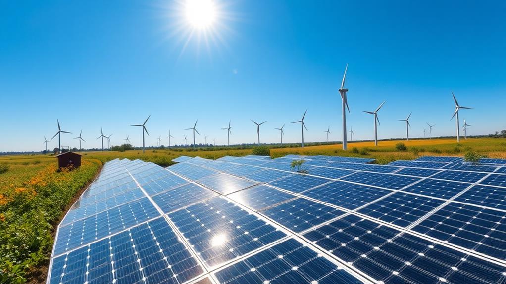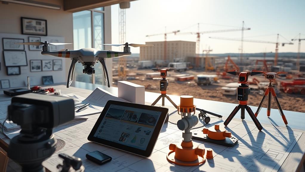
We're transforming site assessments with advanced tools like aerial imagery, high-resolution data, and innovative AI-driven algorithms. Technologies such as the DJI Phantom 4 Pro V2.0 drone provide precise imaging, essential for evaluating topography and shading. Our 3D modeling and machine learning techniques create accurate representations, helping identify obstructions and optimize solar panel placement for peak efficiency. Remote evaluation methods, including tools like Solar Pathfinder, further enrich our analysis. Virtual collaboration platforms enable us to manage projects seamlessly, saving time and resources. These tools mark the future of sustainable energy solutions, and there's more to uncover about maximizing their potential.
Key Takeaways
- EagleView's technology provides high-resolution aerial imagery for precise site evaluations and assessments.
- DJI Phantom 4 Pro V2.0 drone offers top-down and side-angle perspectives for detailed data collection.
- Photogrammetry and 3D modeling enhance solar site assessments through accurate land and structure measurements.
- Machine learning algorithms automate object detection and optimize solar panel placement for efficiency.
- Virtual collaboration tools expedite remote site assessments and improve project management through enhanced communication.
Aerial Imagery Utilization
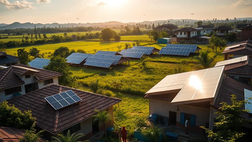
Aerial imagery use is transforming site evaluation within the solar industry. EagleView's technology now allows us to assess potential solar sites without needing to physically visit them. Drones and aircraft, equipped with advanced cameras, capture high-definition aerial imagery, covering an impressive 94% of the U.S. population. This provides detailed top-down and side-angle perspectives essential for accurate site assessments.
Remote visibility aids solar planning and identification of suitable residential properties, conserving time and resources. Advanced 3D modelling using photogrammetry techniques creates precise representations of terrain and structures. This ensures reliability in measurements, critical for successful solar projects.
Machine learning and AI algorithms are enhancing processes through automated object detection and classification in aerial imagery. This streamlining accelerates assessment and initiation of solar projects, fostering progress in our community as we adopt innovative solutions.
High-Resolution Data Collection
In our exploration of high-resolution data collection, we're focusing on EagleView's innovative use of drones and aircraft equipped with advanced cameras. These tools capture detailed imagery that covers 94% of the U.S. population, offering both top-down and side-angle views for thorough analysis.
This capability allows us to accurately assess factors like topography and shading, which are essential for effective solar site planning and optimization.
Detailed Imagery Capabilities
High-resolution data collection has transformed the assessment of solar sites, with EagleView's advanced imaging technology leading this change. Detailed imagery capabilities now allow us to view and evaluate solar sites with unprecedented precision. EagleView utilises drones and aircraft equipped with sophisticated cameras to capture high-resolution aerial imagery, providing crucial information on topography and shading. This data is essential for optimising panel placement and maximising energy production, ensuring every decision is informed and effective.
EagleView's geospatial library is extensive, covering 94% of the U.S. population. This vast coverage offers both top-down and side-angle views, providing a comprehensive perspective necessary for accurate site assessments. Detailed imagery eliminates the need for on-site visits, enabling solar prospecting, planning, and validation to be conducted remotely. The understanding of factors influencing solar energy production is thoroughly enhanced.
For high-resolution imaging, the DJI Phantom 4 Pro V2.0 drone stands out as an excellent choice, boasting a 20-megapixel camera that captures detailed aerial views.
Drone and Aircraft Usage
In terms of site assessments, drones and aircraft equipped with state-of-the-art cameras have transformed the way we gather high-resolution data. This technology enables us to capture detailed aerial imagery crucial for solar site analysis. Advanced cameras are used to collect topographical and shading data, which are essential for optimising solar panel placement and maximising energy production.
EagleView's extensive geospatial library, covering 94% of the U.S. population, provides our efforts with a comprehensive range of top-down and side-angle views necessary for effective solar prospecting and planning. Remote visibility capabilities allow efficient validation and assessment of solar sites without physical presence, conserving time and resources while aligning with our objectives.
Detailed imagery obtained through drone use aids understanding of terrain, obstructions, and shading patterns to ultimately maximise solar energy output. This innovative approach fosters community as we work towards sustainable energy solutions. Utilising these tools, we actively participate in shaping a more energy-efficient future.
Advanced 3D Modeling Techniques
Advanced 3D modelling methods, such as photogrammetry, have revolutionised our approach to solar site assessments. Precise representations of solar locations enable accurate measurements of land and structures. This precision is crucial for identifying possible obstructions and shadowing issues, ensuring optimal positioning of solar panels for maximum energy generation.
Utilising 3D modelling, site characteristics like vegetation and terrain are evaluated with unparalleled detail. This insight is vital for effective solar power generation, aiding in anticipating and addressing challenges. Understanding shadowing patterns, these models serve as invaluable tools for guiding the ideal placement of panels, enhancing energy generation efficiency.
Advanced modelling techniques also expedite decision-making processes. Detailed insights into site attributes and potential obstacles make informed decisions clearer. It's akin to having a detailed map that navigates the intricacies of solar site assessments, fostering a sense of cohesion as we work towards sustainable energy solutions. These advancements unite our objectives for a brighter, more efficient future.
Machine Learning Applications
Machine learning applications in site assessment are revolutionising the evaluation of solar sites. Sophisticated algorithms automate object detection and classification in aerial imagery, reducing manual effort and making site data analysis more efficient. This advancement is particularly beneficial for communities invested in sustainable energy solutions, enabling the scaling of projects and tackling larger challenges with confidence.
Machine learning enhances the accuracy and speed of evaluating site characteristics. For solar developers, it ensures more reliable identification of optimal solar panel placements. Algorithms also identify shading sources and obstacles that could affect solar efficiency.
Streamlining the decision-making process allows for better, faster decisions that benefit projects and the environment.
Together, communities harnessing machine learning power are leading smarter, more efficient solar site assessments. This adoption of technology marks a step towards a brighter, more sustainable future, where collective efforts have a tangible impact.
AI in Data Analysis
Relying on AI in data analysis revolutionises the assessment of solar sites through its ability to swiftly process large datasets and offer precise insights. AI algorithms enable the automation of object detection and classification in aerial imagery, significantly reducing manual effort. This allows us to focus on constructing solar projects more quickly and efficiently.
Machine learning technology enhances scalability and expedites decision-making, enabling us to proceed with confidence and connect with individuals who share a vision for sustainable energy.
Automated data analysis with AI algorithms is transformative for identifying potential shading sources and obstacles in site assessments. Precise identification optimises panel placement, ensuring maximum efficiency from solar installations. We engage with a community that values innovation and sustainability, collaboratively utilising cutting-edge technology.
AI-based tools streamline the assessment process, allowing us to efficiently analyse large volumes of data, making solar site evaluations more effective. These insights equip us with the knowledge to make informed decisions, reinforcing our commitment to renewable energy.
Embracing AI in data analysis not only improves our projects but also fosters a sense of belonging within a forward-thinking community.
Shade and Energy Modeling
In examining shade and energy modeling, we acknowledge that grasping shading patterns is crucial for optimizing solar panel placement. By taking into account factors like latitude, longitude, and seasonal changes, we can accurately simulate the sun's trajectory and forecast shading impacts on a site. This precision enables us to optimize energy production and make knowledgeable choices about solar installations.
Optimizing Solar Panel Placement
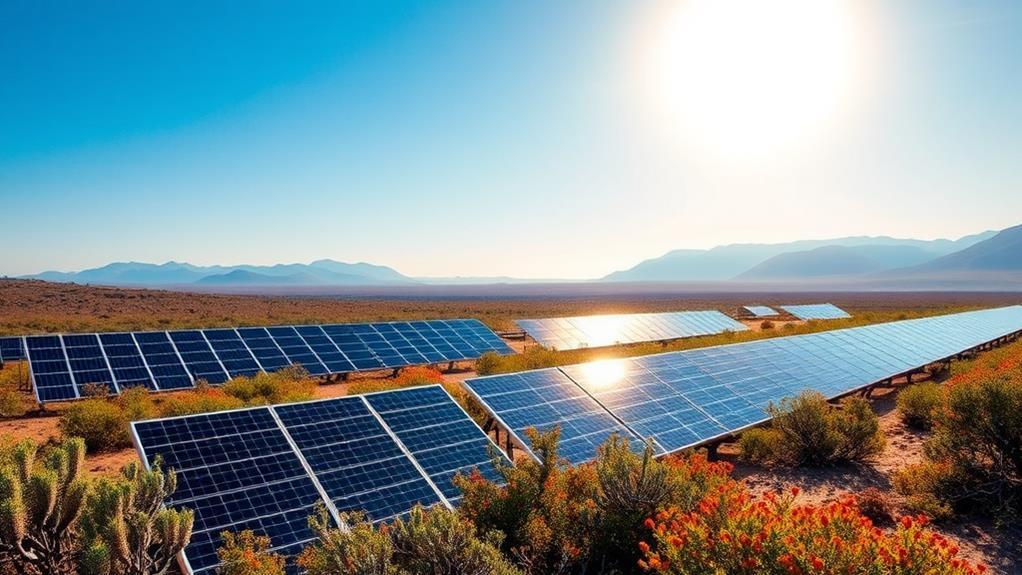
Optimising the placement of solar panels relies on precise shade and energy modelling to enhance energy production. Utilising advanced site assessment tools such as EagleView's technology, it's possible to simulate the sun's path, considering essential variables such as latitude, longitude, time of day, and seasonal changes. This method provides a better understanding of shading patterns and allows for strategic positioning of solar panels for maximum energy generation.
Accurate shade analysis is vital for assessing a site's solar potential. It helps identify obstructions and shading issues, ensuring panels are positioned to capture the most sunlight. This maximises energy output, which is crucial for community-driven solar projects.
With EagleView's 3D modelling, site characteristics, including vegetation and terrain, are assessed to support the mission of achieving peak energy efficiency.
Solar developers recognise the importance of precise data. It informs decisions and unites efforts in the pursuit of sustainable energy solutions. Optimising panel placement boosts energy production while contributing to a sustainable future for communities.
Understanding Shading Patterns
To comprehend how shading affects solar panel efficiency, it's essential to understand the complexities of shading patterns and energy modelling. Shade analysis is fundamental, considering variables such as latitude, longitude, time of day, and seasonal changes. These factors allow accurate simulation of the sun's position, crucial for optimising solar panel placement. Understanding these details can enhance energy production and ensure solar investments are justified.
Conducting a thorough shade analysis enables informed decisions regarding a site's suitability for solar panels. Technology significantly contributes to this process, offering precise shade modelling that identifies potential shading sources and obstacles. This data is invaluable, helping determine a site's solar potential to efficiently harness the sun's energy.
Detailed information on shading patterns is vital for effective site assessment and planning. Knowledge of these patterns connects us to a community dedicated to optimising solar energy use. For instance, using tools like the Solar Pathfinder or Solmetric SunEye can offer detailed insights.
Collectively, this understanding aids in making intelligent, data-driven decisions about solar energy utilisation, fostering a sustainable future.
Remote Site Evaluation Methods
Many in the solar industry now utilise remote site evaluation methods to enhance assessment processes. Technologies such as high-definition aerial imagery and 3D modelling allow detailed assessments of solar sites without physical presence. This approach saves time and ensures accuracy in collected data, fostering a sense of connection and efficiency within the community focused on sustainable energy solutions.
Integration of machine learning and AI algorithms further strengthens remote assessments. These technologies automate object detection and classification, enabling swift understanding of site conditions and potential obstacles. Teams can depend on advanced tools like DroneDeploy for consistent results, boosting reliability and trust within the industry.
Shade analysis and energy modelling tools are crucial for optimising solar panel placement. Simulating sun positions helps determine the best configurations for maximising energy output. This aligns with the collective goal of increasing efficiency and reinforces a commitment to sustainable practices.
These remote site evaluation methods empower informed, impactful decisions without needing to set foot on site.
Virtual Collaboration Tools
Virtual collaboration tools enhance our capacity to assess solar sites effectively without the need for physical presence. These tools promote a sense of unity and inclusivity, allowing us to collaborate seamlessly from any location. Accessing detailed site information remotely strengthens our decision-making abilities, ensuring every team member remains well-informed and engaged.
Remote accessibility offered by virtual collaboration tools conserves time and resources, which is crucial for efficiently scaling solar projects. Reducing the necessity for on-site visits allows us to focus efforts on developing additional projects, advancing our collective aim of sustainable energy development. This commitment fortifies our community's dedication to a greener future.
The accelerated assessment process provided by these tools enhances efficiency and refines project timelines. Quick, informed decisions are possible as all team members remain aligned, irrespective of their locations.
Improved project management fosters a more interconnected and successful team, unified through shared goals and aspirations. Tools such as Microsoft Teams and Zoom facilitate seamless communication, while platforms like Trello and Asana aid in organising and tracking project tasks efficiently.
Conclusion
In our look at tools and technology for site assessment, we've emphasised the use of aerial imagery, high-quality data, and advanced 3D modelling. By incorporating machine learning and AI, we can enhance data analysis and make better decisions. Shade and energy modelling, along with remote site evaluation, provide new ways to assess sites effectively. Let's use these virtual collaboration tools to transform our method and move towards more efficient site assessments.
At Deo Solar, we are committed to providing innovative solutions for your solar needs. Our products include Rail-Less Solar Brackets, End Spacers, Structural Brackets, Ground Mounted Solar Systems, Corrugated Brackets, and Earthing Plates. Our services include the DeoSizer Tool, Evaluation and Design, Maintenance and Support, and Solar Installations.
If you have any questions or need more information about our products or services, please don't hesitate to contact us. We're here to help!